Rather than climbing up, climb DOWN? On a global scale there are many places that have remained forgotten for decades--perhaps centuries! Only knowing the North American Continent, my husband has located many of them?
Both My husband & I get out in the Santa Monica mountains, although it’s only when the weather is miserable in Indiana. Being a bike rider for years in England and America, he finally bought a hand built machine from a friend in Italy. Because he is a health nut, he rides his bike everywhere he can--living most of the summer months in Indiana he has a healthy outlook of riding his bike on country roads. Being a Professor of Earth Sciences he has been interested in mapping since he was a boy.
Even his Grandfather before him collected maps, through the Great War and beyond and left him a magnificent collection. Today everything is high-tech and he complains humorously about the old masters, who spent hours with pen and paper drafting crude maps.
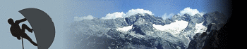
One of the great assets for this type of adventure can be the United States Geological Survey maps. Known Nationwide as Topo maps this can be very detailed survey maps that have been available since their 19th century inception, to the current series. This government "Topo" maps are so accurate, that the early additions would identify even the smallest of human habitat. A common dot was not a blemish on the paper, but would indicate a pioneers shack or cabin. I used these maps for years to find long-forgotten human activity, which would explain small mounds of broken glass of other debris. A good, healthy walk using these cartographic surveys can locate old Indian trails, which can no longer be distinguished on a modern map. Since he was a boy, my husband has been an avid climber and throughout that time has walked away with few broken bones. He has climbed in the blue mountains of Australia, including Mt. Snowden in Britain. He always seemed to be looking for some kind of climbing adventure wherever we go.
The outdoors can be your friend as well as your enemy, so we always take extra water which is just as important as a good map. Contemporary maps rarely show the old trails and hidden watering holes, used for centuries by the native Indians. Early surveys contained a great deal of information, including original landmarks, Indian camps and much more.
While wandering he has located small isolated lakes and streams, full of fish. Acknowledging that the United States has been completely surveyed, with older maps he has discovered forgotten mountain valleys full of wildlife. Wild Turkeys, deer, stag and other creatures that had likely hasn't seen a human being before. Some of these places are way-out of any habitable track, that even a four-wheel drive could ever find a way in. In California, he discovered in the mountains an old mining camp, hidden away from human eyes. Well off the beaten path and no safe access, because a previous earthquake had collapsed the road sometime in the early 1900's. The place was seething with wildlife, including bear, geese, quail, Bobcat--even wild hogs.
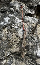
Many of these forgotten places are inaccessible by any avenue but climbing down into these areas. Once there must have been a comfortable way in, but not anymore. I am sure the creatures that live in these enclosed areas have some way to get around, but most of the time my crazy spouse would have to drop down on a rope. Sometimes I have waited hours for him to return from these escapades, but his stubbornness always got in the way—to prove a point. He climbs down into these strange places, to prove his point that these odd places exist—and nobody—nobody hadn’t likely been there for decades! The commentary below about these hidden places gives ample evidence which illustrates that there are many more of these places across America. Every time he goes out, I used to wonder if he would come home?
But other than his need to explore these strange places, he returns home unscathed except for a few bruises. Lately he has teamed up with two other climbers, who follow his unusual ideologies and also are interested in these lost areas. Currently he has a very old 1886 map he gleaned his grandfathers collection of Inyo County, that which is likely very rare and meticulously detailed. It covers such places as Death Valley and the early surveys of this region.
The place he had found was not recognized on a contemporary map, but the early survey labeled the hidden settlement as "Beveridge" It still remains in its solitude, but with the small lake the creatures are never disturbed. Careful though, take your shotgun or a good rifle with you, because the place has some pretty large diamond backs.
By following these almost completely eroded paths that was taken by the tribes you can be almost certain to find drinking water, places of shelter and hunting regions. In all respects it is a matter of their survival, so they knew of small secret places that contained all these elements. This was not just a refuge in the desert, the forests or hidden valleys, but high in the mountain ranges.
You can find these rare and unique secret corners of America, when you study the old maps. I have personally found three such areas, because the native Indians knew of these secluded places where they fished and hunted. Modern maps remain almost infertile to this valuable information, whereas the old surveyors had a knack in producing wonderfully detailed material.
I have been known as "The Maps Lady" because about five years ago, along with my husband who is an old retired Professor we began our business. Although my husband had the knowledge and the means, we were both completely ignorant of the digital industry. Mostly by error and practical hands-on experience we introduced our Global known website. Today our historical map prints are recognized by many academic institutions, including the renowned Johns Hopkins University. People of all walks of life buy our sharp, quality maps. My husband maps have been handed down from his grandfather and many have never even been studied yet.
Some of our best sellers are county land ownership maps, but with such a huge variety available our internet gallery awards the browsing public with a choice. Because only part of the collection has ever been digitalized, we are able to locate early maps of our customer preferences.
If your interested in early county maps of “Say”, Austin, TX, we have them, including Austin, TX County maps. Amongst our considerable library of Maps, Texas County maps are one of our land ownership collections. Meaning they have the original property owners name and the extent of their land purchased. In addition, many of these maps will show the whereabouts of old, forgotten places that excites my spouse. The early maps indicated everything including the sites of homesteads at that time.
Contemporary maps however, hardly, if ever show the location of early home sites. Many of county land ownership maps, have been reduced digitally because of the original size would have covered a wall. But nothing has been lost in the transcription. Even so, these are large and most of these land identity maps display inserts of towns and small villages in that era. They are remarkable because Joe the Blacksmith shop will be shown, along with schools, churches, public buildings, hospitals, asylums jails, banks, professional business just to name a few.
If you are interested in these maps for what ever reason, we can supply these needs. We actually restore and preserve these great icons of our past, so that they are available for future generations. Yes! We do sell them at a very premium price so that we can complete my husband’s on-going project. This project is definitely not by any means a moneymaker, but a way to preserve these magic documents. It costs large sums of money to hire graphic artists, who actually clean each map with new technology computer applications. This brainchild of my other half is a unique chance to introduce these stunning maps to not just academic circles but to the world.
Today our main objective is to preserve and restore, this huge map collection for future generations. Being an he is an old retired University professor, it is instilled in him to operate on a higher plane then most commercial historic map vendors. We have attuned ourselves to offer a high quality product that is first cleaned to within a 90 percent of perfection. However, it would be completely offensive to achieve any degree of the original product, because then it looks as if it had been churned off the press today. The old hand-coloring style and some blemishes remain, so that a map from the War of Independence--looks as if it is two hundred years old, minus tears and human neglect.
http://www.historicmapsrestored.com
All around us are these almost secret places, full of wild animals hiding away in these small sanctuaries.


 lezec.cz